Maps
Questions about Grain Valley's interactive maps? Contact Haley at 816.847.6224 or halexander@cityofgrainvalley.org
Public Information Map (posted 1/11/2023)
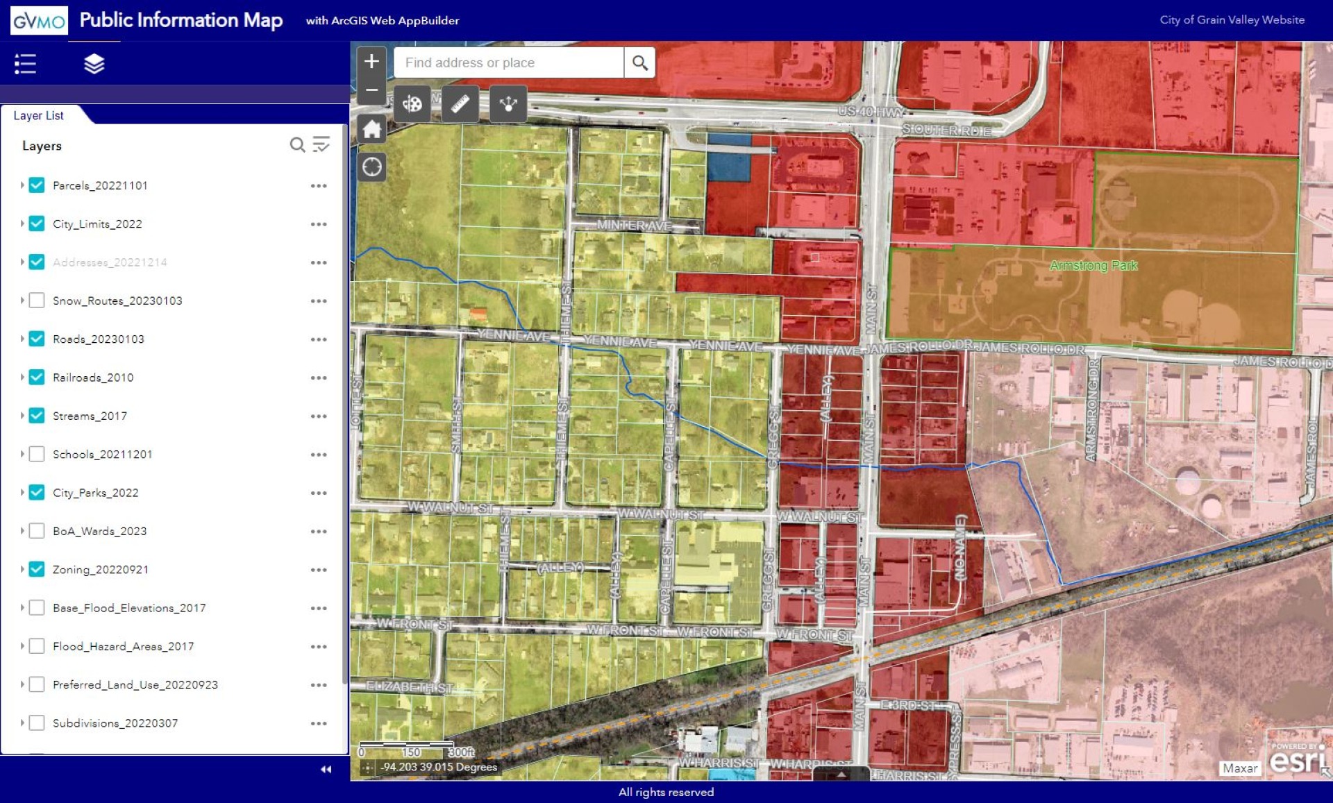
This map contains:
- - City Limits & Annexation Ordinances
- - Jackson County Parcels
- - Zoning, Future Land Use, FEMA Flood
- - Addresses, Subdivisions, and BOA Wards
- - Roads, Snow Routes, Road Ownership
- - Railroads, Streams, Parks, Trails, Schools
Annexations Over Time (posted 4/17/2023)
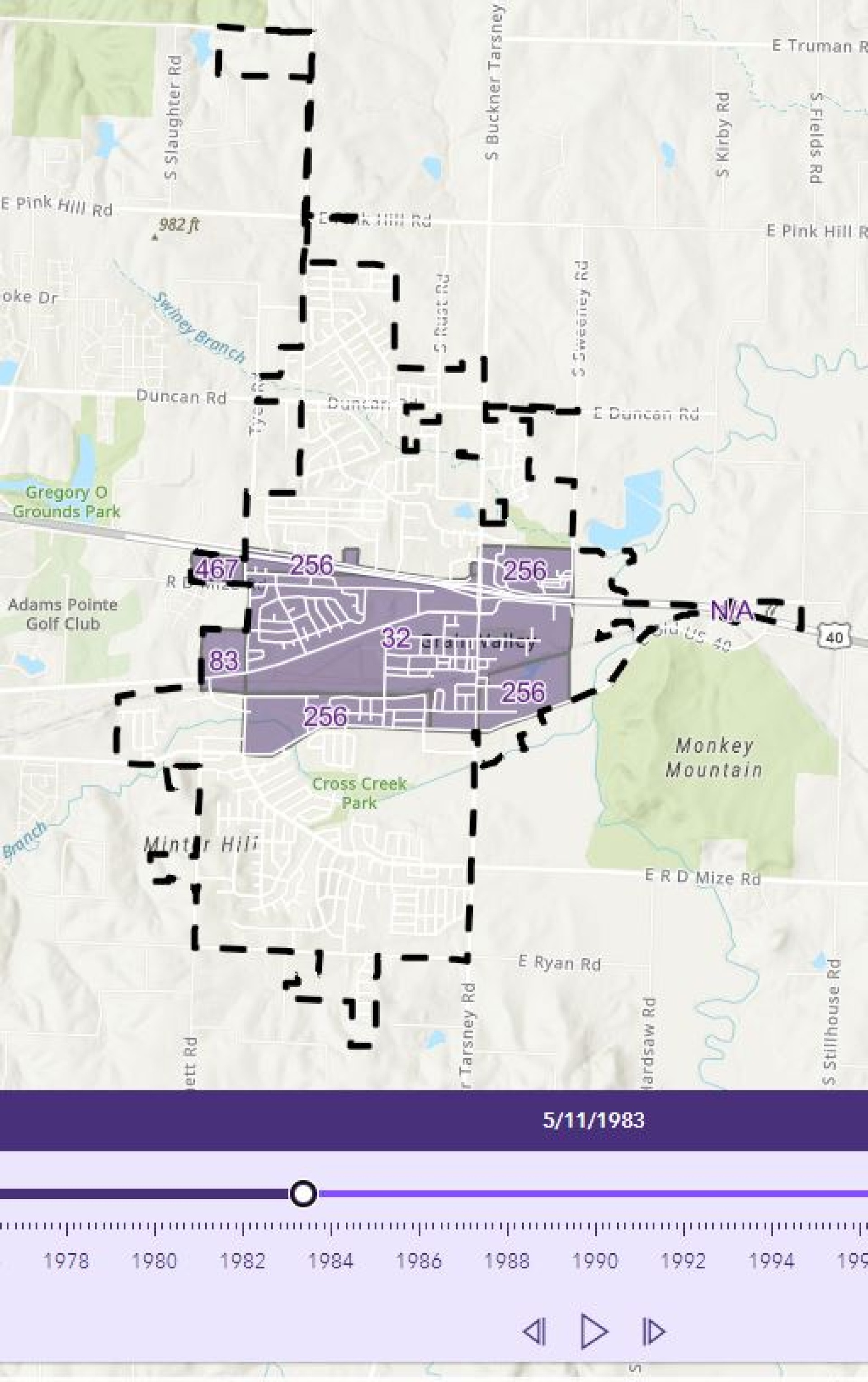
Timelapse map that shows Grain Valley's City Limits grow over time (1956-2023).
Press the "Play" arrow on the time bar to watch as animation.
Other maps available:
- Road Ownership Map (.pdf) (shows who owns roads and how to contact them)
- Zoning Map (.jpg)
- Zoning Map (.pdf)
- Subdivision Map (.jpg)
- Subdivision Map (.pdf)
- Future Land Use (.jpg)
- Future Land Use (.pdf)
- Annexation Map (.jpg)
- Annexation Map (.pdf)
- Emergency Snow Route Map (.pdf)
How to use the interactive map:
Hold down the left mouse button to pan around. Use the mouse's scroll wheel (or the +/- buttons on the map) to zoom in or out.
Click on the "Layer List" button (under the map title) to view what is available and visible. Layers can be turned on and off with the checkbox next to the layer name. Turning on all layers at once will complicate the map view. You can click the dropdown arrow next to the layer to see its legend.
Click on the "Legend" button (under the map title) to list the legends for all the visible layers.
Layers with detailed labels will only be visible when zoomed-in, so that the features and labels won't overlap. Example: Address Points are only visible when zoomed to street level.
Shapes can be drawn on the map with the "Draw" button in the upper left (paint palette symbol).
Information about an individual feature is available by left-clicking on the feature inside the map. The pop-up window will display info for every feature at that location, so if results say "1 of 4", scroll through each window with the arrows to see different feature's info. To simplify the pop-up results window, zoom-in close to small features and turn off layers you are not using.